

Kenjalgad or Ghera Khelanja Fort, (Wai Taluka) 4,269 feet above sea level, is situated on the Mandhardev spur of the Mahadev range eleven miles north-west of Wai. It is a flat-topped hill of an irregular oval shape, about 250 yards long and one hundred yards wide at the extremes, looking remarkably strong both from a far and near. But on ascending it is found to be commanded by the Yeruli Asre and Doicivadi plateaus about two miles to the east which are easily ascended from the Wai side, and the Jambli hills about a mile to the west.
The fort forms a village in itself but has to be ascended from the villages of Asre or Khavli which lie at its foot on the Wai side. The ascent is by about two miles of a very steep climb or the Asre-Titeghar bridle path can be followed for two miles and then a tolerably easy path leads due west from the pass another mile on to the fort. The fort is a black scarp rising vertically from the main ridge which is hogbacked.
Map :
 Getting there :
Pune > Go to TITEGHAR or KORLE or AMBAVDE > The route leads up to MACHI (5 Kms) where a good shelter is available.
Go with Trek Group :TrekDi Trek Group
Check out the details here
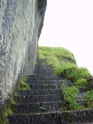
SNAPSHOTS :

Map :
 Getting there :
Pune > Go to TITEGHAR or KORLE or AMBAVDE > The route leads up to MACHI (5 Kms) where a good shelter is available.
Go with Trek Group :TrekDi Trek Group
Check out the details here
SNAPSHOTS :

Kenjalgad Front View


Nice Info Dude
My Blogs
http://freebollywoodmoviedownload.blogspot.com/
http://hollywoodfreemoviedownload.blogspot.com/
thnx dude